
North Las Vegas ZIP Code Coverage
The 2024-25 city profile associates fourteen ZIP codes with North Las Vegas. Seven are principal citywide ZIPs with profile totals, while seven are marked partial, associated, or outside/partial. The distinction matters. The principal group is useful for city-scale context, but an exact address still needs a current USPS result and a parcel or municipal check. The table preserves the profile’s coverage description without treating postal service areas as city borders.
| ZIP | City-Profile Coverage | USPS Handling | North Las Vegas Note |
|---|---|---|---|
| 89030 | Principal citywide ZIP | Verify exact address and recognized city | Older central area; ZIP alone is not a city test. |
| 89031 | Principal citywide ZIP | Address and city/state modes | Large service area; check municipality. |
| 89032 | Principal citywide ZIP | Exact-address mode | Adjacent municipal-label complexity. |
| 89033 | Associated, partial | City/state and ZIP-to-city modes | No citywide profile information. |
| 89081 | Principal citywide ZIP | Exact-address mode | Confirm parcel and jurisdiction. |
| 89084 | Principal citywide ZIP | Exact-address mode | Aliante and north-city context; not a legal boundary. |
| 89085 | Principal citywide ZIP | Exact-address mode | Smaller northern area; verify current result. |
| 89086 | Principal citywide ZIP | Exact-address mode | Confirm city and parcel jurisdiction. |
| 89087 | Associated, partial | ZIP-to-cities and address modes | Exact city share is not supplied in the profile. |
| 89101 | Associated, outside/partial | City/state and ZIP-to-cities modes | Nearby records can use another municipality. |
| 89115 | Associated, partial | Exact-address mode | Industrial and eastern regional area. |
| 89124 | Associated, partial | Exact-address mode | No citywide profile figure. |
| 89130 | Associated, partial | Exact-address mode | Verify city line and county jurisdiction. |
| 89165 | Associated, partial | Exact-address mode | Exact service geography needs USPS confirmation. |
The seven principal ZIPs total 273,754 people and 89,870 residential units in the report-year profile. Those figures describe a dated snapshot, not a current count or a roster. The profile’s asterisks on partial areas are a useful reminder to keep postal, municipal, and parcel geography separate.
Note: The profile’s principal and partial labels describe associated ZIP geography, not a complete city-boundary crosswalk.
North Las Vegas ZIP Code Verification
The USPS ZIP Code Lookup supplies three different checks. By address, it tests a delivery address. By city and state, it returns ZIPs associated with a named city. By ZIP, it returns cities served by that ZIP. USPS warns that a ZIP result does not confirm that a person or company is at the address, and a broad address can produce multiple matches that need a unit or narrower street input.
| USPS Mode | Required Fields | Useful Result |
|---|---|---|
| By address | Street Address; City; State | Delivery ZIP and recognized city. Company, Apt/Suite/Other, and ZIP are optional inputs. |
| By city and state | City; State | All ZIPs associated with that city label. |
| By ZIP | ZIP | Cities covered by that delivery ZIP. |
The official lookup illustrates its address, city/state, and ZIP search choices.
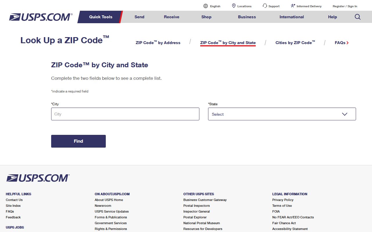
Keep the returned postal city exactly as shown, then compare it with the city map and the county’s parcel record. That preserves a useful postal fact without relabeling jurisdiction.
Search a North Las Vegas ZIP Code
A ZIP code directory can narrow a research path, but no verified official North Las Vegas portal safely returns every resident in one ZIP. USPS provides address and postal association data, not occupants. The Clark County Assessor offers owner, address, parcel, subdivision, and related property modes. OpenWeb is map and parcel based. Election sources publish statistics and lawful file routes, while city permits are address based.
- Enter the full address in USPS and record the recognized city, ZIP, and any unit detail needed to resolve multiple results.
- Check the North Las Vegas maps page for the ZIP map and the city’s related geography layers.
- Search the Clark County Assessor by address or APN. Save the site address, legal description, parcel number, and jurisdiction information.
- Open the parcel in Clark County OpenWeb, then compare the municipality, tax district, census tract, ward, and parcel geometry with the postal result.
- Use the Recorder or a dated directory only after the parcel and legal description point to the right place.
When the ZIP has narrowed the location to a named road or block, the North Las Vegas Street Directory provides the address-keyed property and recorded-document route. ZIP geography is the filter, not the end of the verification.
Note: Save the USPS result before changing an address component so a later parcel search can be reproduced.
North Las Vegas Postal Addresses
North Las Vegas uses the broader Las Vegas Valley grid. Its addressing ordinance describes a number, directional prefix, primary street name, and suffix. The city engineer or Public Works authority controls addressing, and the ordinance describes ranges of 0-100, ten blocks per mile, and an approximate 528-foot block interval. A missing direction, changed suffix, or old postal-city label can make a directory result look absent even when the parcel is the same.
This geography clue is especially useful in the northern development areas associated with Aliante, Tule Springs, and the Apex or industrial corridors. Neighborhood names locate planning, plat, permit, or map material, but they do not establish a household or association membership. Preserve the whole address string before changing any component for a second search.
Note: A directional prefix and an APN can resolve an address mismatch more safely than assuming two similar street names refer to the same parcel.
North Las Vegas ZIP and Parcel Keys
A ZIP is a delivery geography; an Assessor Parcel Number is a county property key. The Clark County Assessor’s documented modes include owner name, address, parcel number, subdivision name, parcel type, book and page, parcel maps, road documents, recorded documents, and building sketches. A parcel card can show an owner, site or situs address, mailing address, legal description, value, map, and history links. It does not list every occupant.
OpenWeb adds parcel geometry, ownership rows, tax district, flood, planned land use, legal description, and elected-district fields. The map is reference material, not a survey. If a postal city and a parcel jurisdiction disagree, record both values. A difference may simply reflect how delivery and municipal systems define their own boundaries.
North Las Vegas Postal Map Layers
The North Las Vegas maps page brings the city ZIP map together with city maps, Clark County OpenWeb, zoning and land-use maps, wards, census tracts, redevelopment maps, and master-plan street and highway maps. These are different layers, and each gives a different answer. A ward connects an address to city representation. A census tract is a statistical area. A tax district concerns county administration. None of them is interchangeable with a USPS ZIP.
For a North Las Vegas ZIP code directory search, save the map layer and date used for each conclusion. A city map can establish a municipal relationship, while OpenWeb can tie an address to a parcel and jurisdiction panel. The Assessor can then provide the APN and legal description, and the Recorder can supply dated document context. That chain avoids treating a broad postal association as a location decision.
North Las Vegas Postal Labels
Postal city labels and municipality labels can differ without signaling an error. USPS assigns delivery routes and recognized city names. The city assigns addresses in its authority. Clark County assigns APNs and maintains assessment records. In a postal directory, record the exact postal label, North Las Vegas municipal result, APN, and source date as separate fields. This is useful when an old deed, permit, directory, or court file carries a Las Vegas label for land that a current city map places in North Las Vegas.
Historical searches need the same care. The city was incorporated in 1946, while Clark County’s modern record trail begins in 1909. A land or family record can therefore use an older regional label. Test an uncertain record with its legal description, lot and block, or APN rather than relying on the postal city alone. This postal directory provides a geographic starting point, not a substitute for the county record.
When an address does not produce a parcel, do not assume it is invalid. The city addressing office, road-document listing, or a recorded map can clarify an assigned address or a changed street reference. Keep each returned label with its source instead of forcing every record into one postal-city description.
North Las Vegas ZIP Boundaries
ZIP boundaries do not follow North Las Vegas city limits. An address can use Las Vegas as its USPS city while the parcel lies in North Las Vegas, and an associated ZIP can extend into land outside the city. Annexation, development, wards, census tracts, tax districts, and postal service areas create overlapping maps. The City Charter also ties municipal territory to plats filed with the County Recorder and Assessor, which is a different system from a postal route.
Boundary check. For a partial ZIP, preserve the USPS label, full address, municipality, APN, and source date. Do not use a ZIP alone to include or exclude a North Las Vegas record.
North Las Vegas Postal Terms
Postal terms describe delivery, not title or legal jurisdiction. Using the right term makes a North Las Vegas ZIP search easier to document and less likely to confuse a delivery result with a parcel fact.
- ZIP Code
- A USPS delivery geography associated with addresses and postal city labels.
- ZIP+4
- An added four-digit delivery detail that narrows a ZIP for sorting. It does not identify a resident.
- PO-box ZIP
- A ZIP used for post-office boxes rather than a claim that all addresses in the ZIP share one municipal boundary.
- Unique ZIP
- A ZIP assigned for a specific delivery arrangement. It still needs an exact USPS and jurisdiction check.
- Carrier route
- A mail-delivery grouping used by USPS. It is not a census boundary, property roll, or household directory.